With October getting older, Seattle should be getting colder.
Instead, our aging month will be turning back the clock to late summer by midweek.
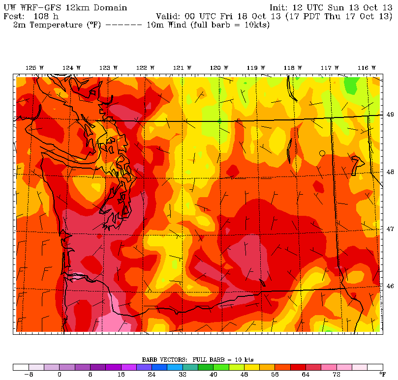
Temperatures are forecast to approach 70 degrees in the metro area as early as Wednesday, thanks to a gigantic ridge of high pressure taking up residence off the West Coast. That’s roughly on par with the average high temperatures seen around here in mid-September—during the twilight of summer.
Already, the mammoth ridge—currently centered over the Eastern Pacific—has made itself noticed, contributing to a spectacular fall day around Puget Sound. With the sun taking over after a round of morning fog, Seattle basked under clear skies for the second Sunday in a row.

We’ll do it one better tomorrow, with less in the way of fog and more in the way of sunshine from the get-go. After a chilly start, the mercury should bounce back to 60 degrees—a mark we haven’t touched since hitting 61 last Monday. (Consequently, that kicked off a weeklong stretch of below-normal high temperatures, including today’s max of 59.) Overnight lows tomorrow will still be cool, though, dipping into the mid 40s.
Tuesday starts off clear as a bell, but we’ll see things become increasingly hazy during the afternoon as a weather system glides by to the north. Any rainfall amounts should be limited to the Canadian side of the border late Tuesday night, but most of the region will wake up to a little more cloudcover on Wednesday as October officially passes middle age.
The clouds quickly burn off Wednesday morning as the sprawling ridge of high pressure reasserts itself over the area. By the afternoon, ample sunshine should be enough to take us well into the mid 60s—with places south and east of Seattle creeping toward the coveted 70-degree mark.
On Thursday, with high pressure parked nearly overhead, we’ll rise up another notch or two, leveling off very close to 70 degrees. Were this a day earlier, we’d be talking about record-breaking warmth (Oct. 16’s record high temperature is 70 degrees from 2002), but alas, the all-time mark for Oct. 17 is a balmy 74—and it’s very unlikely we’ll get that warm.
Conditions look to remain the same for Friday and Saturday, however, setting the stage for possible daily records then—the mark to beat for both days is 70 degrees. Long-range weather models then keep the ridge of high pressure in place through next Sunday, giving Seattle another shot of warmth as October heads into the final third of its life.
Not bad for a month getting pretty long in the tooth, huh?


