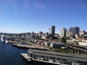
Borderline toasty temperatures, with highs rising well into the mid 80s?
Tuesday must be right around the corner.
For the third straight Tuesday in July, the mercury is predicted to swell some ten degrees beyond normal as hot weather comes within a stone’s throw of Western Washington. Already this month, two of the top three warmest days in Seattle belong to Tuesday—the number one spot is held by Monday, July 1—with last Tuesday soaring to 86 degrees, while July 2 peaked at 83.
Before the heat builds again, we’ll see one more pleasant day tomorrow, with highs hovering around the 80-degree mark amid a cool, refreshing breeze from the north. Skies should remain crystal clear throughout, with low temperatures Monday into Tuesday dropping into the mid 50s—similar to what’s on tap later tonight.

We then go for three out of four on Tuesday as some balmy air sneaks over the Cascades, boosting high temperatures near 87 degrees—about as warm as it can get around here before the word “hot” comes into play. South of Seattle, hot will be the name of the game, with temperatures approaching 90 degrees from Olympia on down to Portland.
The heat breaks by the mid-evening hours, but Tuesday won’t be going quietly into the night. An upper level low racing north from the Oregon coast will barrel through the Sound just after sunset, destabilizing the air mass overhead and sparking a round of nighttime thunderstorms. Because the air at the surface will stay pretty dry—we’re not expecting any muggy weather on Tuesday—most places won’t get any rain from these storms, but there should be enough lightning to ooh and aah about overnight.
Marine air rushes in behind the low on Wednesday, cooling Seattle’s highs into the lower 80s—still a good five degrees above the mid-July average. West of Olympia, most spots will start off the day shrouded in low clouds and fog—but the greater Seattle-Tacoma area should dodge the morning gloom. Sunshine is expected across all of Western Washington by noon.
A strong area of high pressure centered over the Rockies then slips to the west on Thursday, sending readings back into the mid 80s, where they’ll likely stay through Friday, if not Saturday.
Sigh—as if any of these days can give Tuesday a run for its money.


