Hitting the mid 80s at this point last year would have gotten Seattle all worked up.
This time around, we’ll barely break a sweat.
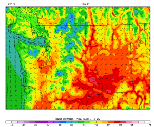
Temperatures are set to top out at 83 degrees on Tuesday—a number Seattle has already exceeded six times this year but reached only once through last July. Preceded by a cool June that registered a monthly high of just 76 degrees, the 83-degree reading on July 8, 2012 stood as Seattle’s warmest of the year until hot weather blew into the city in early August.
Talk about a late start to summer. Did we even dig out the fans before Seafair?
We’ve done a 180 in 2013, thanks to last week’s early season heat wave and May’s historic warm spell. In addition, temperatures overall have been running on the plus side of normal since mid-spring—May finished 2.6 degrees above average, while last month came in tied as Seattle’s fourth-warmest June on record, with an average high of nearly 74 degrees.

The trend has spilled over into this month, with July so far over 5 degrees ahead of its normal pace as dry, sunny weather sets in. Warm temperatures will continue through Tuesday, with highs approaching the 80-degree mark late tomorrow afternoon before rising another couple of degrees on Tuesday.
A more stubborn marine layer surges inland Wednesday morning, keeping clouds overhead until the early afternoon as high temperatures cool into the mid 70s. An upper level system passing by to our north on Thursday will bring back the morning clouds once again, with temperatures dipping a few notches into the low 70s.
Friday features partly sunny skies and similar readings, before warmer air sneaks back into the region over the weekend. By next Sunday, highs could again crack 80 degrees—headline news in 2012.
And par for the course in 2013.


