First, it was the winter that wouldn’t start.
Now, it’s the winter that won’t end.
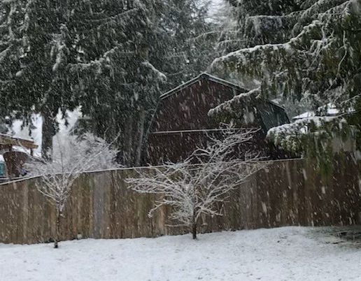
After finishing the November-through-January period without a single flake of snow, winter turned on a dime in Puget Sound, burying Seattle in 20.2 inches of snow in early February. Then, in what will likely go down as our second-to-last hurrah with the white stuff this season (more on that in a second), another 0.8 inches of snow whitened Seattle Thursday morning—the city’s first measurable March snowfall in seven years.
Seasonal snowfall total up to 21 inches
The latest blast of wintry weather brought Seattle’s official snowfall total for the season to 21.0 inches—the most since 23.3 inches fell in the snowy winter of 2008-09. Even more impressive, the entirety of this winter’s snowfall has occurred on just seven days. In 2008-09, the seasonal snowfall total was spread out over 19 separate days.
2018-19: Snowiest winter in a decade
This winter is now Seattle’s 11th-snowiest on record since the city’s official weather station was moved to Sea-Tac Airport in 1945. Should another 2.4 inches fall at the airport before spring kicks in, 2018-19 would go down as Seattle’s snowiest winter in 47 years—since 29.2 inches blanketed the city in the winter of 1971-72.
More snow on the way?
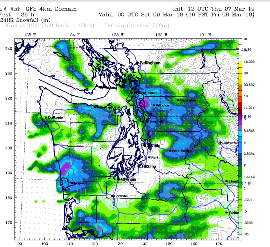
While an additional 2-plus inches looks unlikely at Sea-Tac through the end of the week, the snow threat remains elevated from downtown Seattle northward tonight into Friday morning. This morning’s WRF weather model, run by the University of Washington, suggests that a Puget Sound Convergence Zone may develop over Snohomish County late tonight, dropping 2 to 4 inches of snow as far north as Mount Vernon and as far south as the King-Snohomish County line.

If this model is correct, the northern half of Seattle—from downtown up to 145th Street—could pick up an inch or two of snow shortly after midnight tonight. The Convergence Zone is likely to fizzle well before reaching Sea-Tac, so the city’s 21-inch total will likely remain unchanged.
Is it ever going to warm up?
Today will be Seattle’s 34th consecutive day with a below-normal high temperature—a remarkable streak of cold weather that’s been intact since Groundhog Day. The normal high temperature for this time of year is 52 degrees, yet most days this month have been stuck in the 40s. Yesterday, in fact, was Seattle’s coldest March day in ten years
For winter-weary and bone-chilled Seattleites, there is some hope, however. Long-range forecast models hint that this persistent cold weather pattern may finally come to an end by the middle of next week, with highs approaching the mid-50s next Wednesday and Thursday.
In other words, normal March temperatures by typical Seattle standards—but downright tropical in light of 2018-19’s wintry grip.


thats coo! wish it snowed more down south, but it always sno up north. tho, in feb 2017 it snowed lot in south. and in 2018 it snoed way to south for me
also, the sno stuck on the roads in renton:)
other places, even in da north didnt get any