

Well, that escalated quickly.
An arctic front ripped through Puget Sound Sunday afternoon and evening, whitening lawns and hurtling temperatures toward the freezing mark in just a few hours’ time. The light snowfall officially measured 0.2 inches at Sea-Tac Airport—where Seattle’s weather records are kept—and slightly more north and east of the city.
Fortunately, for snow fans hungering for something more substantial, yesterday looks like it was just the appetizer.
Consider late tonight and tomorrow the main course.
Snow accumulations begin late tonight across the metro area
After a relative lull in the action for the rest of the daylight hours—save a few flurries here and there—snow looks to pick up in a hurry tonight as a system over Canada dives southward. By midnight, a steady snow is likely throughout the Sound—including in Seattle, Everett and Tacoma. Temperatures will generally be near freezing or a few ticks below, meaning any snow that falls should stick to surfaces right off the bat.
The snow is likely to intensify from about King County northward on Tuesday morning, with the mercury hugging the freezing mark in Seattle near dawn. South of the city, milder air surging in from the Pacific will probably lift temperatures a few degrees, making for a rain/snow mix during the daylight hours in Tacoma and points southward. It’s possible some of this warmer (relatively speaking!) air could nudge as far north as downtown Seattle, but at this point in time, it appears more likely that the rain/snow line will stay south of the city. North of downtown Seattle, precipitation should stay all snow, all day, on Tuesday.
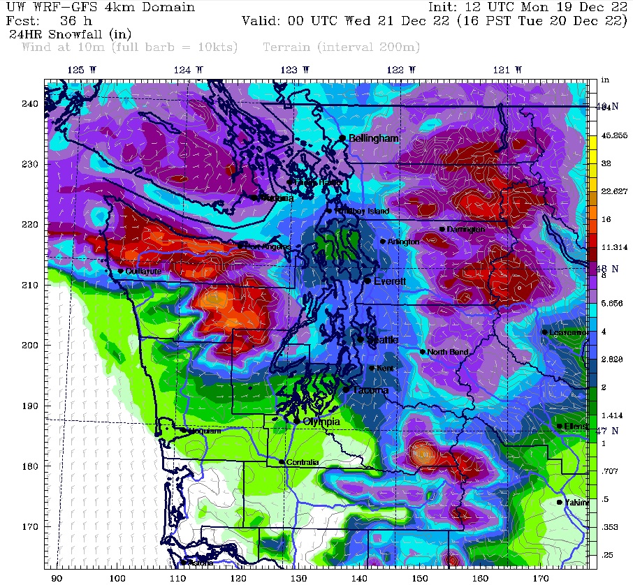
How much snow is likely in Seattle?
From late tonight into early tomorrow afternoon, 2 to 4 inches of snow is likely across most of Seattle, with higher amounts (up to 6 inches) possible to the north and east. The snow should taper off by mid-afternoon, with just scattered flurries Tuesday night. If more than 3.4 inches accumulates, it will be the city’s biggest snowstorm since Dec. 30, 2021.
For Seattle, a snowfall between 2 to 4 inches is typically a moderate snowstorm—not enough to cripple the city (i.e., no December 2008-style snowpocalypse), but certainly enough to cause problems on most roadways, not to mention hills. Thinking about driving down Queen Anne tomorrow? Think again.
Will there be enough snow to build a snowman? Or to have a snowball fight?
Perhaps just as importantly, Tuesday’s system should drop enough snow to appease multitudes of children (and some adults, including this author) up and down Puget Sound. In other words, if you’re venturing out tomorrow, be prepared to encounter many a snowman or snowball—along with some hearty holiday cheer.
Because for Puget Sound snow fans, when it snows in Seattle, it’s the most wonderful time of the year.


