
Cold to start, warm to finish.
Seattle notched its chilliest low in over three months this morning, dipping to 50 degrees under clear skies just before sunrise. However, the nippy weather didn’t stick around for long, with temperatures rebounding into the mid 70s this afternoon as high pressure strengthened overhead.
We’ll stay on the warmer side of things tonight as well, with increasing clouds ahead of a frontal system holding low temperatures near 60 degrees—several degrees warmer than the mid-September norm of 52. (This morning actually marked the first time since Aug. 6 that Seattle’s low temperature wasn’t above average—a remarkable span of 43 days.)
Tomorrow dawns on a gray note as a cold front over the Eastern Pacific slowly limps toward us. Not all hope is lost, though—temperatures will still rise into the low 70s before high pressure loses its grip.
The front stumbles ashore early tomorrow evening, ultimately spreading light rain back into the Sound by 9 p.m. Since the front will be weakening as it treks east, rainfall amounts won’t add up to much—just a tenth of an inch or so for most of the area. With the cloudy, drippy skies, the mercury will stay parked in the low 60s for most of the night.
On Saturday, upper-level low pressure noses in behind the front, increasing our rain chances as the day wears on. Fortunately, with a bit of a rain shadow kicking in around Seattle, it doesn’t look too wet, with a quarter-inch of rain possible south and east of the city, and even less from downtown north and west. Highs will stay cool, though, peaking near the 65-degree mark.
After a calm start to Sunday, a more potent rainmaker roars in around noon, dumping a solid half-inch of rain across the metro area during the afternoon and evening. A midday burst of wind is also likely in Seattle, with gusts up to 30 mph as the front barrels through. North of Everett, speeds could approach 40 mph—especially over Whidbey Island and the San Juans.
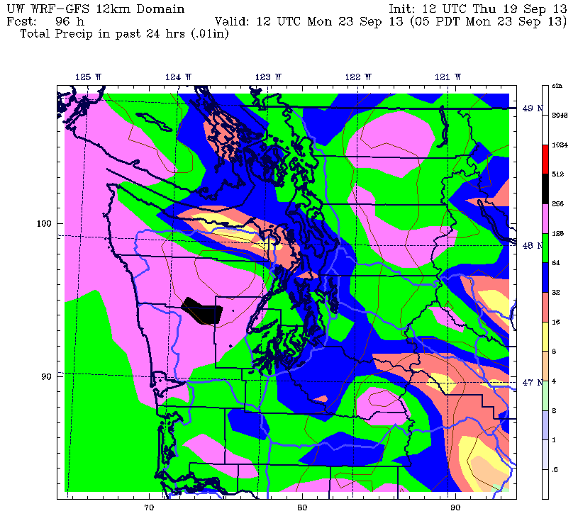
The soggy weather sticks around into Monday, with leftover showers plaguing the region through the better part of the day. Most areas will collect another half-inch of rain, with noticeably lighter amounts near Everett thanks to the Olympic rain shadow. Under damp skies, the first full day of fall will certainly feel autumn-like as thermometers struggle to climb past the lower 60s.
The on-and-off rain hangs around into Tuesday, before a ridge of high pressure finally springs up mid-week, shutting off the faucet and booting away the clouds for Wednesday and Thursday.
Wet to start, dry to finish—next week doesn’t sound all that bad, does it?


