
What, did fall get a stern talking-to or something?
A year after showing up a good three weeks late, the autumn season arrived precisely on time today as a strong cold front blasted through in the early afternoon, dousing Seattle with a half-inch of rain as the calendar officially flipped from summer to fall.
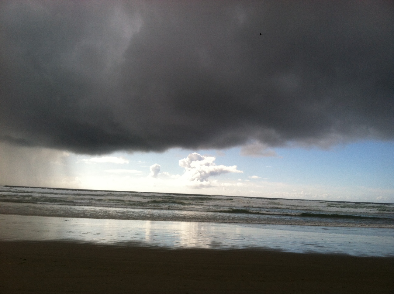
If only Mother Nature would have had the same talk with summer a few months ago, much of the city would have been spared the humiliating soaking that welcomed in the season on June 20.
With summer now officially in the rearview mirror, a cool and showery stretch will set in for the next several days as low pressure asserts itself along the West Coast. High temperatures will max out in the lower 60s through Wednesday—Seattle reached just 63 today—as we alternate between pop-up showers and sunbreaks. Overnight lows will also take a hit, nosediving into the upper 40s by the middle of the week.
For the rest of this evening, scattered bands of moisture will continue to drift in from the ocean, raining on some areas and missing others all together. The mercury should slowly sink into the upper 50s as the night lengthens, eventually bottoming out in the mid 50s under partly cloudy skies.
A mix of sun and clouds greets morning commuters tomorrow, with the best shot for rainfall further north in Snohomish and Skagit counties. With the upper-level winds largely blowing from the west, the Olympic Mountains will act as an umbrella for Seattle on Monday, soaking up most of the incoming rain before it can reach the city.
On Tuesday, some colder air skirts down the coastline into Oregon, triggering more widespread showers around Western Washington. Some of these could evolve into thunderstorms, complete with heavy rain and even small hail—with the highest odds out along the coast and further south near Portland. Temperatures will remain cool throughout, hovering around 60 degrees.
The shower threat fades as we head into Wednesday, with more sun returning to the picture, albeit with continued chilly temperatures. With generally clear skies overhead by late Wednesday, the mercury should fall like a rock around Puget Sound, reaching the 40s on Thursday morning for the first time since late May. Fortunately, abundant sunshine will push thermometers back into the upper 60s—normal for early fall—by the end of the day.
The pleasant weather lingers into Friday, with more sun and readings close to 70 degrees, before a slow-moving front takes aim at the Northwest next Saturday.
Guess fall figures that it better keep the number of sunny days to a minimum, or risk the ire of Mother Nature once again.


