Last year, we kicked off October with 11 straight days of rain.
This year, things couldn’t have begun on a more different note.
With no rain expected until Friday, the first 11 days of the month will go down as completely dry—Seattle’s driest start to October since 1991, when rain held off until the 16th of the month. In addition, the lack of any moisture today means that at day’s end, we’ll have only seen .03 inches of precipitation since July 23—making for the driest 80 days on record.
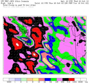
Soak it up now, because by this weekend, we’ll be drenched.

The long-awaited start to our rainy season gets underway Friday as a cold front marches in. The front will reach the coast after midnight, spreading rain into Puget Sound by mid-morning. Light rain will fall throughout the afternoon, tapering off around the evening commute. Highs will top out around 60 degrees, dropping only into the mid 50s overnight due to heavy cloud cover.
The rain picks up again early Saturday, especially east of Seattle. Showers will continue on-and-off throughout the morning, with breaks in the rain likely during the latter half of the day. Wet or dry, it’ll remain cloudy throughout, with highs only in the upper 50s.
A stronger system slams into the region on Sunday, with steady rain—possibly heavy at times—and breezy winds. Rainfall amounts on Sunday will likely top half an inch in most of the metro area, with lighter totals north toward Everett thanks to the Olympic rain shadow.
Yet another wet day is possible on Monday, before things calm down a bit Tuesday. By then, most of us will have been doused with over an inch of rain in just a few days.
Call it payback for our never-ending summer.
And it’s only just beginning.


