After a couple days of relatively benign weather—sunshine, fog, and the occasional raindrop or two—a much more active weather pattern is on tap for the Seattle area, just in time for the holiday weekend.
Scattered light rain showers roaming around the area this evening will dissipate as we head into the overnight hours, with the temperature holding steady in the mid-40s. As we get into Friday morning, we’ll actually see the mercury rise a little bit, as warmer winds in advance of our next rainmaker nudge temperatures up into the lower 50s. The morning commute should be relatively dry, with the greatest chance of some light rain in the South Sound.

Just after the noon hour on Friday is when things will get downright wet. A strong front will barrel through the area from the southwest, brining a steady rain to the entire Seattle area Friday afternoon. The heaviest rain is likely to fall in the 3 to 6 p.m. time frame—payback time for the moisture-free morning commute!
Late Friday night, the rain will taper off, turning to showers as some much cooler air moves into the region. By Saturday morning, snow levels will plummet to 1,500 feet (and likely even lower by the afternoon) as a cold area of low pressure settles over the region.
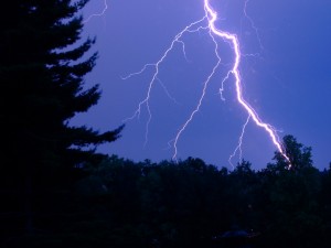
The low responsible for the downturn in temperatures—we’ll be lucky to get out of the mid-40s on Saturday—will also help to kick off some pretty strong showers later in the day. Some of these showers could contain ice pellets and/or wet snow, and be accompanied by thunder and lightning. (Thunderstorms…in Seattle…in February? What’s next, the Sonics returning? Er, actually…)
Showers will continue into Saturday night and Sunday morning, slowly winding down as the low scoots off to the east. By Sunday night, Seattle should be all but done with the rain—that is, the rain associated with this system. Forecast models show another wet system taking aim at the region later Monday into Tuesday, albeit with warmer temperatures.
Keep that umbrella handy.


