Our soggy February is ending on a dry note.
After 18 straight days of rain, the skies have stayed precipitation-free over Seattle since yesterday, with stormy weather targeting areas to the south for a change. The damage has already been done around Puget Sound, however—through today, we’ve collected a whopping 6.11 inches of rain at Sea-Tac this month. That’s good enough for the seventh-wettest February on record at the airport—and the most rain we’ve seen in a month since last September.
Fortunately, we’ll continue to dodge the drops late tonight into Friday, with moisture from a storm system down in Oregon remaining just beyond our neck of the woods. Temperatures will also continue to run on the balmy side, only dipping into the mid-40s overnight—after a high of 55 degrees this afternoon.
Tomorrow starts generally cloudy, with some sunbreaks mixing in as we move into the afternoon. For the third consecutive day, peak readings in the city will top out in the mid 50s—a couple pegs above the late February norm of 51 degrees.

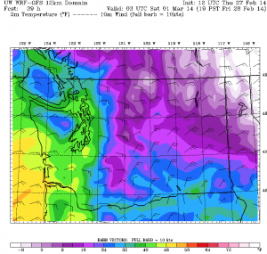
It’ll be a much different story further north, where cold air over B.C. will once again leak out of the Fraser River Valley into Whatcom County. As a result, highs in the Bellingham area will struggle to make it past the low 40s on Friday as another chilly blast moves in. Conditions, however, look dry for all of Western Washington.
The clouds thicken up a bit as the weekend unfolds, with a few stray showers drifting across the region during the afternoon. By then, the colder air will have slipped far enough south to send highs tumbling into the mid 40s around Seattle—a good ten degrees cooler than in recent days. North of Everett, maximum temperatures might not even crack the 30s.
We stay dry and cloudy into Sunday morning as a warm front slowly creeps northward, ultimately tossing some moisture back into the area during the second part of the day. For Seattle, Everett and Tacoma, light showers should begin rolling through just after lunchtime, increasing a little bit in intensity as evening sets in. With the mercury hovering near 40 degrees, precipitation should be in the form of rain, not snow—although it’ll be a close call later Sunday night, as temperatures fall off into the mid 30s. Still, it looks like a rain/snow mix at best for the metro area.
The forecast does appear a little whiter for Whatcom and Skagit counties on Sunday, as the cold air will be more firmly entrenched—pumped into the region by ’round-the-clock northeast winds. A few inches of snow is possible there by Monday morning—but at this time, it doesn’t look like anything close to last Sunday’s drubbing.
Back in the Seattle area, we’ll see a moderate rain at times into Monday, with temperatures bouncing back to near 50 degrees by the afternoon as warm air rushes in off the Pacific. Rain then continues on and off through the first week of March as damp weather digs in its heels.
Let’s just hope we can break for some sunshine by week two.


