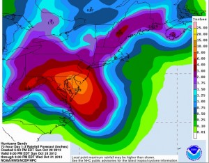
We could get over two inches of rain by the end of Halloween.
In other words, one-fourth of what will inundate Philadelphia and Washington, D.C. in the same time span.
While damp even by Seattle standards, our upcoming soggy stretch—heavy rain tonight into Monday, and another inch of rain on Tuesday—is small potatoes compared to the devastating storm set to cripple the Eastern Seaboard tomorrow through Wednesday.
With an astonishingly deep low pressure for an East Coast hurricane—which translates to an incredibly wide area of strong winds extending out from the storm’s center—and copious bands of heavy rain, Hurricane Sandy truly is an unprecedented storm for the Mid-Atlantic and Northeast. Forecast to roar ashore in southern New Jersey as a hurricane Monday night, Sandy is expected to unleash nearly ten inches of rain in places like Atlantic City, N.J., Dover, Del., and Maryland’s Eastern Shore as it slowly moves inland. Hurricane-force wind gusts, reaching over 80 mph, are also likely.

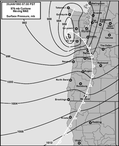
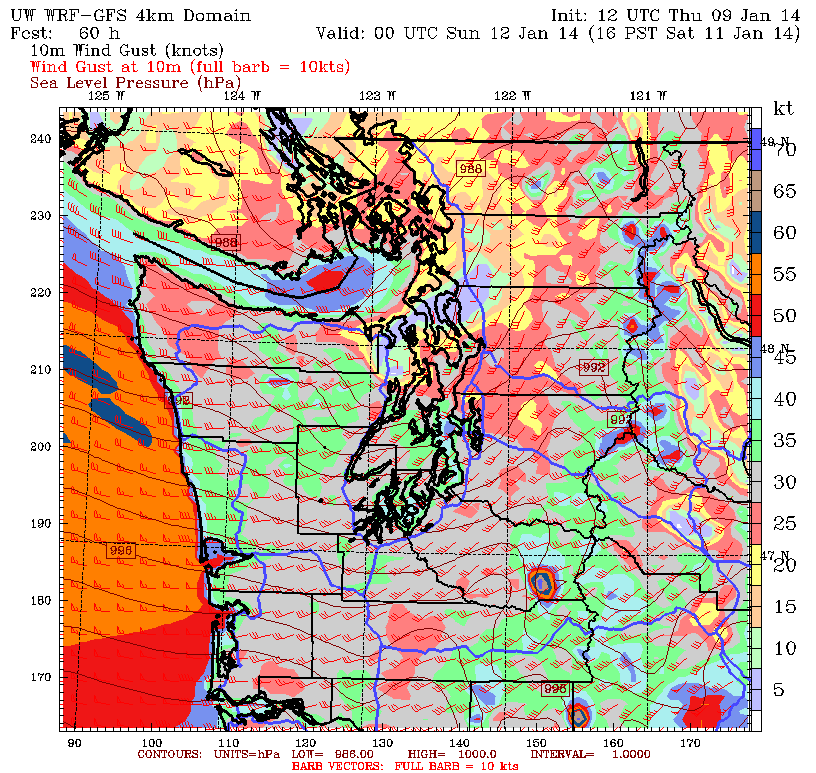
Just to the west, along the Washington-Baltimore corridor and north to Philadelphia, eight inches of rain is possible by Wednesday evening, with gusts to 70 mph between midday Monday and Tuesday night. To put that into perspective, wind gusts from D.C. to Philly will be roughly on par with the top speeds seen in the Seattle area during the peak of the 2006 Hannukah Eve Windstorm. (Sea-Tac Airport saw its highest wind gust on record, 69 mph, just after midnight on Dec. 15, 2006.) The big difference? These winds will rake the Mid-Atlantic and Northeast for 24 to 36 hours—whereas the December ’06 storm really only battered Seattle for about six hours.
Believe it or not, the wind will be even stronger to the northeast of Sandy’s landfall, with the New York City metro under the gun for gusts up to 80 mph. In addition, the nation’s largest city is also bracing for four inches of rainfall and a storm surge that, when coupled with a high tide, could send 10 feet of water into Lower Manhattan.
The worst of the storm should be through New York City by Tuesday afternoon, with the wind and rain also abating further south as Sandy weakens and moves into upstate New York. Calmer, drier weather then takes hold on Halloween—no doubt a welcome sight.
Unfortunately, until then, Sandy will be quite a fright.


