We haven’t seen rain in 46 days and a high below 70 in 38.
By Monday, we’ll have witnessed both.
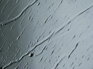
That’s because the earlier-advertised weak cold front is still on track to blow through Seattle Sunday night into Monday, giving us our first measurable rainfall since July 22. Cooler air will also invade the region as clouds spread in ahead of the front, capping high temperatures in the mid-60s—Seattle’s coldest high since July 30.

But first, it’s going to get hot.
Higher pressure over the Mountain West will cause the winds to blow from the east Friday and Saturday, drawing warm air over the Cascades and into Western Washington. This will create a thermal low off the coast (Portland meteorologist Mark Nelsen has a nice explanation about how these lows form), sending temperatures well into the 80s around Puget Sound.
The hottest day of the two looks to be tomorrow, with the mercury forecast to hit 87 degrees in Seattle. Further east toward the foothills, temperatures will probably break 90 degrees, especially in places like Issaquah and North Bend. Overnight lows will also be quite balmy Friday night, ranging from the upper 50s in the metro area to the low 60s in foothill communities.
The warmth backs off a bit for Saturday, but we’ll still see highs in the low to mid 80s across the region—a far cry from the following day’s cloudy, 65-degree weather.
As for rain? Right now, it’s most likely to spread north to south late in the day on Sunday—possibly meaning that Sea-Tac could be kept dry until early Monday. If that’s the case, the Seattle dry spell will end at 49 days—the second longest on record. If, however, rain falls at the airport Sunday night, our streak will have to share second place with 1922—which had 48 rain-free days back in the era when weather records were taken at the Federal Building downtown.
Either way, the dry stretch of 2012 is one for the books.


