Rain is at least a week away.
With a massive ridge of high pressure over the Eastern Pacific shunting all moisture well to our north and south, the extensive dry spell that’s gripped Seattle since mid-summer will continue unabated for the next seven days.
And what a spell it’s been. The meager .03 inches that’s fallen at Sea-Tac since July 23 has made for the driest two-and-a-half-month period in Seattle in 90 years. By Saturday—day 76 of the dry stretch—it’ll be the driest such time in Seattle history, eclipsing the current record set over 75 days, back in 1922.

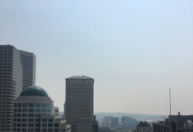
We’ll also be topping out well above average come Saturday, with high temperatures rising into the low 70s. (The average high for early October is only 64 degrees.) Skies will remain sunny through the weekend, although easterly winds will make for progressively hazier conditions as smoke from the wildfires in Central Washington drifts through the passes.
Largely sunny weather will continue into the middle of next week, with just a chance of some morning clouds Monday and Tuesday. With no rain expected through Wednesday, the first ten days of October will go down in the books as bone-dry—with no rain, not even a trace, recorded at Sea-Tac. (For those wondering, our driest October from start to finish—October 1987—saw just .31 inches.)
The latest long-range models agree that the area of high pressure responsible for the unusual fall weather will get booted to the east next Thursday, allowing for a rain-bearing front to approach Western Washington. If current trends hold, we could finally see our first October rainfall next Friday.
180 hours from now.
Not bad for a place known for its around-the-clock rain.


[…] having difficulty concentrating. It doesn’t help that the weather in Seattle went from a long streak of sunny days to darkness and […]