
The first batch of rain rolled through before breakfast this morning—too early for most folks.
The next round, however, is scheduled to show up by the lunch hour tomorrow—possibly sticking around for dinner.
Hungry for a half-inch drubbing, Seattle?
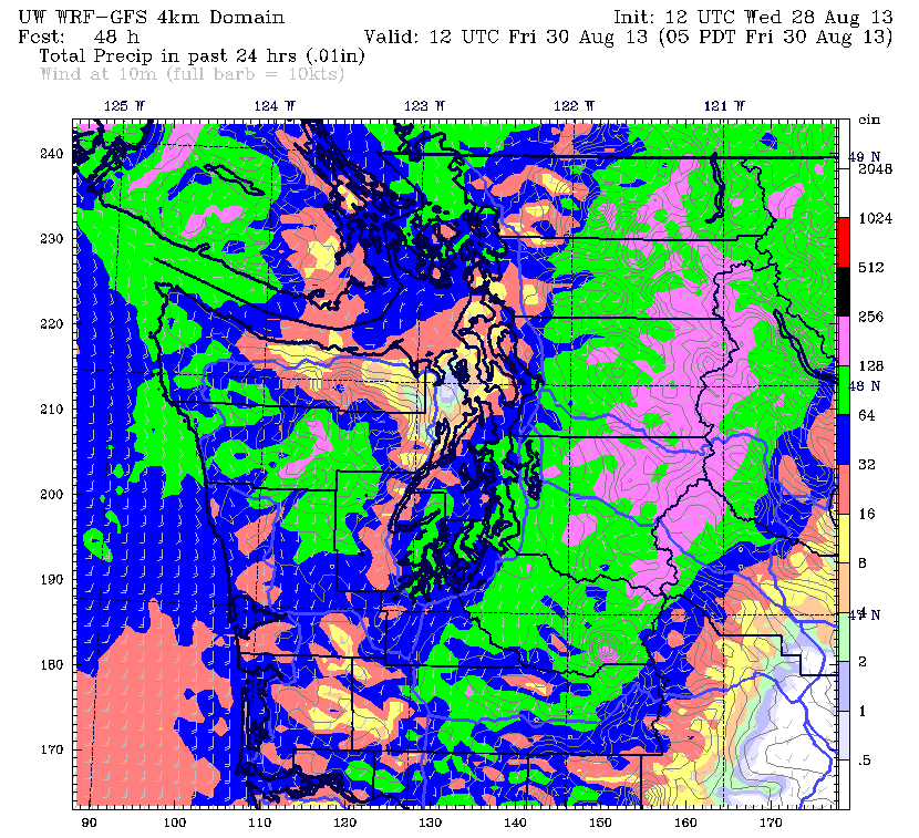
After an early morning storm brought 0.21 inches of precipitation to the city today, a strong cold front is poised to more than double that tomorrow, unleashing an intense round of showers over the metro area during the second part of the day. Rainfall totals with this system could even top 0.50 inches from Seattle southward, possibly making tomorrow the soggiest day in Puget Sound since mid-April.
Between now and then, however, we’ll catch a decent break, as partly sunny skies allow the mercury to flirt with 80 degrees once again (Seattle also hit 80 yesterday). However, things will stay on the sticky side, with plenty of leftover moisture from recent rains giving the air that classic muggy feel.
The clouds thicken in haste later tonight as the cold front approaches the coast, holding temperatures well above normal. In fact, many locations will struggle to fall out of the mid 60s—roughly ten degrees balmier than our average low of 55. (Side note: this August is on track to break the record for Seattle’s warmest monthly average low temperature. Through yesterday, the average low for the month is 59.7 degrees—above the current record of 58.4 established in August 1967.)
The mild night gives way to a warm, drippy morning tomorrow as light showers begin moving into the region. Rainfall should gradually increase throughout the morning, with the real punch arriving around noon. Bands of moderate to heavy showers will then rotate through the city during the afternoon as the cold front closes in on us, with a chance for some thunder and lightning in the strongest storms.
The front blasts through late tomorrow night, cutting off any lingering appetites for additional rainfall. In fact, by Friday morning, we’ll largely be in the clear, with just a few holdover showers in the foothills. Sunshine will follow in the afternoon, with highs in the mid 70s.
A temporary ridge of high pressure sprouts up over Western Washington Saturday and Sunday, boosting temperatures into the lower 80s for a good chunk of Labor Day weekend. Skies should be mostly sunny both days.
By Monday, we’ll see an uptick in clouds as the next soggy system creeps toward us. Whether it’ll be more akin to this morning’s lighter soaking or tomorrow’s predicted dousing remains to be seen—just suffice it to say that by then, most Seattleites won’t be hungry for either.


