Last week, it was a parade of champions.
This week, it’s a parade of storms.
Fresh off the heels of a pair of soggy systems that soaked Seattle Monday and Tuesday, another rainmaker is racing toward the region overnight, followed by additional rounds of wet weather on Friday, Saturday and—wait for it—Sunday.
That’s four storms in the next four days. Back-to-back-to-back-to-back. Even better, by Sunday we‘ll be six-for-seven on the week, with today alone the only one to dodge a dousing from Mother Nature.
Hope you enjoyed the break, Seattle—because it’s parade time again real soon.
The next storm closes in on us late tonight, ultimately spreading moisture back into the area around midnight. A steady rain should fall throughout the pre-dawn hours, tapering to showers by sunrise. Fortunately, this system won’t pack nearly the punch of yesterday and Monday’s storms, dropping just a quarter-inch of precipitation on Seattle before zipping into the Cascades.

Clouds and scattered showers linger through the morning hours tomorrow, especially east of the city, before the sun reappears for the second part of the day. Temperatures should stay mild throughout, hovering in the lower 50s.
The skies cloud up again in earnest Thursday night as a stronger system barrels toward us, arriving at our doorstep early Friday. Rain, heavy at times, will be likely up until the late morning hours on Friday, with roughly 0.75 inches landing in the gauge at Sea-Tac. Winds will also be blustery, gusting to 35 mph as a strong front plows through the Sound.
We catch another breather behind the storm on Friday afternoon, with clearing possible in the afternoon amid lighter winds. Highs will again reach into the 50s—slightly warmer than normal for mid-February.
Lo and behold, the respite will be short-lived, as the next juicy system blows in from the southwest midday Saturday. Wet weather will be the rule of thumb Saturday afternoon and evening, with rainfall totals exceeding half an inch.
After a few hours of dry conditions to kick off Sunday, the final system arrives early in the afternoon. Of all the storms, this one should be the wettest, with an inch of rain likely in Seattle—and possibly much more. Right now, the worst of the rain looks to fall Sunday night, accompanied by strong winds (gusting up to 45 mph) shortly thereafter.
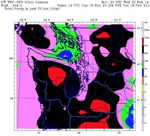
More showers continue into Presidents Day, with additional bursts of heavy rainfall possible in the afternoon. By the time the long holiday weekend winds to a close Monday night, Seattle will likely have picked up 3 inches since Friday alone—and close to 5 inches in the past week.
Not to rain on your parade or anything.


Winter is back in the PNW! Thanks for the update on what to expect this weekend.
It sure is nice to be getting some active weather for a change!