Déjà vu, anyone?
After sunny, pleasant conditions to start the week—Seattle hit 70 degrees Monday and crept up to 72 yesterday—the weather has begun its inevitable downward trend as we head toward the weekend. While today’s stubborn cloud cover is finally fading away, gray skies will be back in full force by Thursday night as rain rapidly approaches—with another round in time for Sunday.
Welcome to the spring of 2014—the spring of lousy weekends.
Rain has fallen in Seattle on either Saturday or Sunday for five weeks straight, dating back to April 19 (0.54 inches). Another 0.40 inches then leaked from the skies the weekend of April 26-27, followed by an astounding 1.94 inches May 3-4—an entire month’s worth of precipitation in just two days. Admittedly, things have quieted down since then, with just 0.02 inches on Saturday, May 10 (nothing the day after)—and less than a quarter-inch for most of the city last Sunday. (Somehow, Sea-Tac Airport skated by with just a trace.) Still, given how warm and sunny the majority of days this month have trended, it’s uncanny how cool and damp the weekends have been.

Before we descend into the gloom once more, partly cloudy skies are a good bet through tomorrow afternoon, with highs in the upper 60s—a few notches above average. Clouds will then stream in from the west tomorrow night as a weak cold front nears, holding overnight lows up in the mid 50s.
Showers swing into the region Friday morning, with the bulk of the moisture gliding through by lunchtime. Behind the front, however, a Puget Sound Convergence Zone is likely to set up shop near Everett, keeping the rain going well into Friday night for much of Snohomish County. Highs will slip into the mid 60s area-wide.
Leftover showers linger into Saturday morning north and east of Seattle, but all of the region should be dry by midday. The sun should break through by then as well, making for a partly sunny afternoon, with peak readings around 65 degrees. If you’re planning on spending some time outside during the long holiday weekend, this is the day to do it.
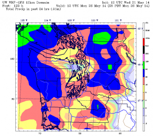
Skies cloud over in earnest by Sunday morning as another front sails in from the northwest. Fortunately, it looks like rain will hold off until later Sunday afternoon for the greater Seattle area, with the heaviest stuff not arriving until nighttime. All told, this front should pack a little more punch than Friday’s, with a quarter-inch or more possible in the city.
Memorial Day then dawns on a damp note, with occasional showers throughout the day, especially north of Seattle. On the bright side, we should be treated to several sunbreaks between the showers, with drier conditions ultimately settling in as the day winds down.
Given that a new workweek starts on Tuesday, that’s only fitting.


Love this blog! Thanks!
Scott S on Vashon Is.
Thanks, Scott–appreciate your readership!
I refer to your blog frequently. Thank you for your weather data and hard work.
Thanks, Wayne–glad to hear it!