Time’s up.
Our two-day hiatus from the rain expires tonight as light showers spread into the region, followed by a burst of heavier rainfall tomorrow morning. By noon on Friday, a third of an inch is likely to have accumulated in the gauge at Sea-Tac Airport—making our already damp March even soggier.
Oh, and a much bigger storm is set to barrel through this weekend.
First up, though, let’s focus on the dry—while we still can.
Filtered sunshine is in the cards for the next few hours ahead of tonight’s system, with temperatures darting into the mid-50s—not quite as balmy as yesterday’s high of 61, but warm enough. Clouds then fill in quickly by early evening as a warm front pushes in from the coast, bringing a threat of showers to the metro area tonight. Fortunately, most places should escape with less than a tenth of an inch of rain.

After the stronger stuff sweeps through around sunrise tomorrow, we’ll revert back to mostly dry, with more sunbreaks possible in Seattle. Further north, however, things won’t quiet down nearly as fast—a Puget Sound Convergence Zone is likely over Snohomish County, keeping the rains going into Friday afternoon. With chillier air dropping in overhead, thunderstorms could also be on the docket for the Everett area—along with hail and gusty winds.
The Zone shifts into the Cascades by tomorrow night, leading to a much calmer evening across the region. Under partial clearing, lows should bottom out in the mid 40s—down from a high of 55 earlier in the day.
Thick clouds return to the area again on Saturday as a warm front lurks to the north, dumping a steady rain on the Canadian side of the border. By noontime, the front will begin sagging south into Western Washington, dampening the skies over Whatcom and Skagit counties. Across Puget Sound, it looks like we’ll eke by dry through the afternoon—with temperatures staying mild in the mid 50s.
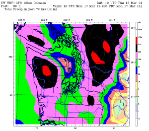
The rain barges into Seattle Saturday night, increasing in intensity as the calendar flips to Sunday. Moderate to heavy rainfall is likely through Sunday morning, with up to an inch for Seattle proper—an amount that would lift the city’s monthly total past 7 inches. Should that happen, March 2014 would move into fifth place on the list of Sea-Tac’s all-time wettest Marches—trailing only 1950 (8.40 inches), 1997 (8.15 inches), 2012 (7.20 inches) and 1971 (7.12 inches).
The drenching looks to gradually come to an end Sunday afternoon, with rain changing over to showers as cooler air filters in. Still, we won’t be completely rid of the moisture until later Monday, when high pressure pops in from the west, shutting off the faucet at last.
The way this March is going, though, it’s only a matter of time before it turns on again.


