A thick blanket of gray clouds has hovered over Western Washington for much of the day, making the blue skies of yesterday a distant memory. Unfortunately, more gray is in store for the area tomorrow, and into the first part of next week, before we undergo a marked change in our weather midweek.
But first, enter the rain.
 |
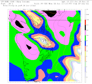
| The Seattle metro can expect as much as .50″ of rain by Sunday afternoon. |
The bulk of the wet stuff will actually hold off until tomorrow morning, with just scattered showers falling tonight, mainly up around the King-Snohomish County line. Tomorrow morning is when things look to get wet, as a warm front approaches from the coast. Rain should begin falling around 6 a.m. or so, continuing on and off throughout the day. We might see a temporary lull in the rainfall mid-day, before steadier rains resume Sunday afternoon and evening.
Temperatures, which currently reside in the mid-40s, will jump close to the 50-degree mark by noon tomorrow, where they’ll remain for the rest of the day. Rainfall totals through Sunday afternoon look to be anywhere from one-third to half an inch of rain, with lighter amounts north of the city.
By late tomorrow night, the heaviest swath of moisture will have moved through the region, leaving us with just isolated showers for the Monday morning commute. Overall, Monday will be a moisture-free day–a good thing, considering that more rain is likely on Tuesday.
By Wednesday, however, the weather pattern will really start to change, as a large ridge of high pressure builds over the West Coast. Current models indicate that we could be completely dry from Wednesday afternoon through at least next Saturday. If this pans out, we’ll be making a serious run at the record for the longest dry stretch of 2012 so far: three days, set Jan. 11-13 (you can already hear those Californians chortling). In addition, temperatures late next week could rise as high as the mid-50s–the warmest we’ve been since the first week of January.
Time to break out the shorts–right, L.A.?


