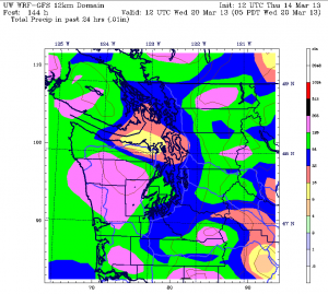
Maybe we should just dub it the forecast wrecker?
The Olympic rain shadow turned predictions for a deluge of rain upside down this week, ensnaring the Seattle metro in a web of dryness the majority of the time. Instead of 2 inches of rain in 72 hours, we collected just 0.22—an amount barely worthy of an umbrella.
The dismal totals—no doubt appreciated by most—were the result of strong winds blowing from the west above the surface. As these upper-level winds crossed the coastline into our state, they slammed into the Olympic Mountains, wringing out most of their moisture along the western edge. Places like Forks took the brunt of this, with the city measuring a whopping 5.47 inches on Tuesday and another 2.02 yesterday.
By the time the winds made it over the Olympics and down into Puget Sound, the air was markedly drier, resulting in very little rainfall around Seattle. Normally, the upper-level winds come from the southwest during our storm season, which causes the rain shadow to form northeast—rather than due east—of the Olympics. That was the thinking earlier this week, but clearly, the winds had a different course in mind.

Thanks to the change of heart, Seattle’s monthly precipitation total sits at just 1.20 inches—nearly a half-inch under what we typically see in the first two weeks of March. We’ll add a little to that this afternoon and evening—but not much—as a weak cold front drags through, dropping a tenth of an inch of rain or less. Temperatures will stay mild in the upper 40s overnight.
Tomorrow dawns mostly cloudy but dry, with an uptick in showers in the early afternoon. The Seattle area should escape most of the action, but some light rain is likely up in Snohomish and Skagit counties as well as the Eastside. Highs will again rise into the mid 50s.
On Saturday, a somewhat more organized cold front arrives in the afternoon, with rainfall totals approaching a quarter of an inch. Behind the front, a Puget Sound Convergence Zone will linger, keeping the shower activity going from Seattle to Everett all the way into Sunday morning. It’ll also turn noticeably colder Saturday night, with temperatures falling into the lower 40s.
The cold continues into Sunday, although the rain peters out early, with most places dry by noontime. Highs will hover in the upper 40s—possibly making it our first sub-50-degree day in a week. Cloudy skies should prevail for the most part, but a couple sunbreaks are possible in the afternoon.
Partly sunny weather is more likely on Monday, with a windy, wet system on tap for Tuesday and Wednesday. Driven by a strong area of low pressure, this storm has the potential to be quite soggy, with some models predicting a solid half-inch of rain in Seattle both days.
Assuming, of course, that the forecast wrecker—er, Olympic rain shadow—returns to its normal stomping grounds.


Thank you for the updates. I’m one of the few people who actually love the rain that makes our area what it is-a green, beautiful place to live. I hope that we actually can get a lot more rain during the spring.
Thanks for visiting the site–and great point, there’s no way Seattle would be so pretty without all the rain! It definitely looks dry for the next week or so around here, but at some point, I’m sure the pendulum will swing back the other way.