Sunny and dry on some days, cool and damp on others. When all is said and done, this April is likely to wind up in the “not half bad” category.
The only problem? We’ve still got plenty of the bad half left.
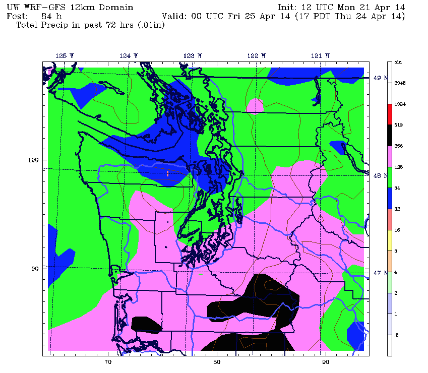
After a warm, enjoyable first part of the month—Seattle collected just over a third of an inch of rain during the first two weeks—April has done a 180 on us, dumping 1.70 inches in the gauge at Sea-Tac since last Wednesday, with several more soakers to come.
The first in the series is already upon us, with light- to moderate-rain churning north up the I-5 corridor. As nightfall sets in, look for the rain to increase in intensity, with the heaviest amounts falling around midnight. By early morning, most places will have picked up a solid half-inch.

The rain fizzles as we move further into Tuesday, with partly cloudy skies and afternoon temperatures squeaking into the mid 50s—quite the cool-down from today’s balmy high of 63. Isolated showers will still lurk across the region, particularly near the foothills and south of the city—but the greater Seattle metro should stay dry.
Wet weather returns later tomorrow night as a healthy band of showers zips through, dropping up to a quarter-inch of rain across Puget Sound into Wednesday morning. Once the moisture moves east, we should see some partial clearing—but readings will stay cool, with highs struggling to crack 55 degrees.
The real action arrives Wednesday night as a strong frontal system barrels ashore, unleashing up to an inch of rain from Seattle to Olympia through Thursday afternoon. Gusty winds will also sweep through the region behind the front, topping 30 mph in some spots—run-of-the-mill stuff for November, but downright blustery for the final week of April.
We slowly dry out as we inch toward the weekend, with shower activity becoming more hit-and-miss on Friday—albeit with chillier-than-normal temperatures. Yet another system then takes aim at the region on Saturday as the less-than-ideal portion of our “not half bad” month continues.
That’s starting to look like a little too generous of a term for April, isn’t it?
Sidenote: The Seattle Weather Blog will be on a spring break of sorts through the end of the month. No new posts until early May (unless something crazy and unexpected happens). Something tells me, though, that I won’t be able to resist the lure of Twitter entirely… -Justin


Still Up to 18 inches of rain below avg for some coastal areas and up to 8 inches of rain below avg for parts of Puget sound as well since Oct 1 , the bottom line we need much more rain too end this drought were in, LET IT RAIN.