Where was this moisture when we needed it?
After a nine-day layoff, precipitation is finally falling from the skies over Western Washington—but alas, it’s wet, not white. With arctic air having breathed its last on Tuesday, temperatures across the board are too warm for anything wintry—be it snow, freezing rain or the all too tantalizing Seattle special, the rain/snow mix.
Instead, it’s back to routine damp, gray weather for the remainder of the day, with milder winds off the Pacific nudging us into the lower 40s. The bulk of the rain should slide through the metro area by early this evening, with lingering showers dying off overnight.
We’ll see mostly dry but overcast conditions tomorrow, with temperatures starting out nearly ten degrees warmer than in recent days—the upper 30s versus the upper 20s. Not surprisingly, Seattle hasn’t popped above normal in the morning since Dec. 1, when the low temperature came in at a balmy 46. Ever since, overnight lows have ranged from freezing to frigid—remember Saturday’s 19 degrees?

Afternoon highs, of course, haven’t fared much better, with the early December average of 47 degrees surpassed just once—again on the 1st of the month. Tomorrow looks to continue that trend, but it’ll be close—the mercury should level off at 45.
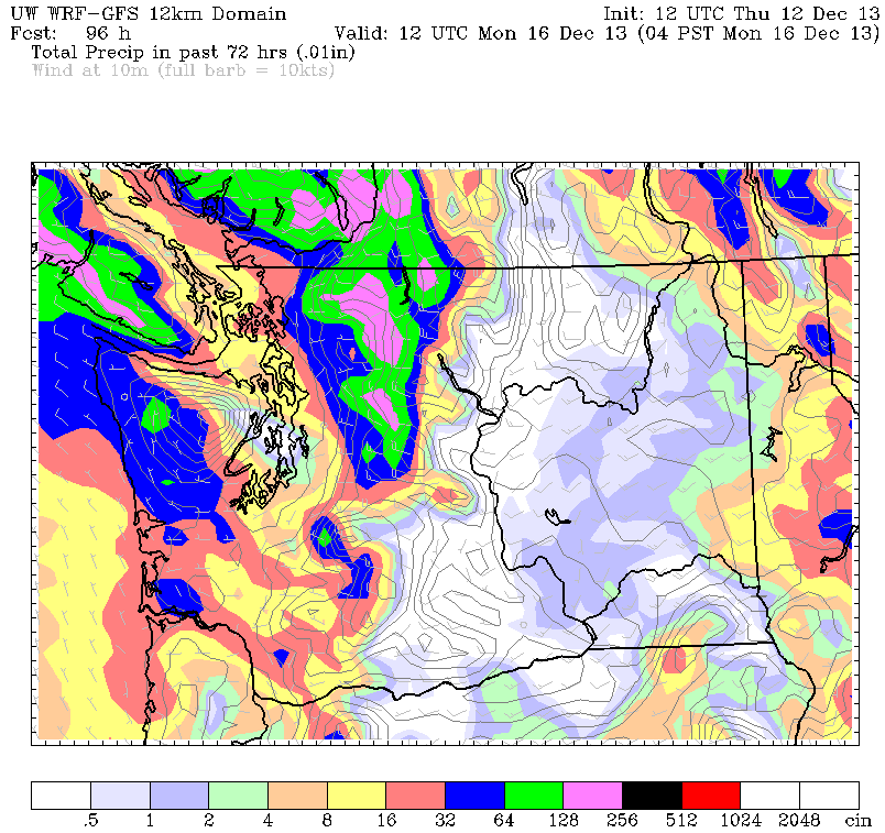
The cloudy weather hangs on through the weekend, although Saturday will at least dawn on a dry note—the next dose of showers isn’t expected until the afternoon. Rainfall with this system should be even lighter, with the Seattle area lucky to squeeze out a tenth of inch.
Occasional showers and drizzle dot the region on Sunday, with breaks in the overcast taking temperatures close to the 50-degree mark—above average at last. Next Monday and Tuesday will also top out in the upper 40s, with dry conditions region-wide.
Speaking of dry, it’s been quite the tame fall around here, with Seattle receiving less than half its normal rainfall from Oct. 1 through yesterday. The past three weeks especially have been a joke by our usual soggy standards, with the four days it’s rained—Nov. 29 through Dec. 2—sandwiched between nine-day dry spells. This has helped drive our yearly rainfall total solidly below par—Sea-Tac Airport, where weather records are kept, is at just 31.20 inches this year, compared to the norm of 34.18.
Long-range weather models hint at a continuation of this pattern for the next week or two, with occasional rainy days like today outnumbered by longer stretches of dry weather. Temperatures should also run cooler than normal in the extended range—but there’s no threat of another arctic blast through at least Christmas.
Hey, at least Santa will have an easy time getting around.


