At least it won’t rain all day.
Another slug of moisture is set to drench Seattle tomorrow, but not before 12 hours of dryness ensues.
Cloudy but rain-free skies are in store for the first half of Monday, with the steady precipitation we’ve seen most of today tapering off by midnight. The Monday morning commute should be solidly dry across all of Western Washington, with even the beleaguered coast (Quillayute Airport near Forks has seen over five inches of rain since Friday) catching a break.

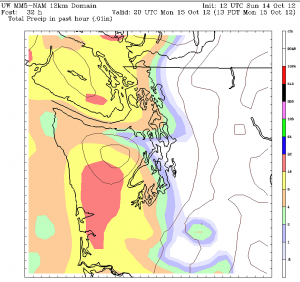
The calm conditions will quickly change in the early afternoon as a powerful area of low pressure moves inland north of Vancouver Island, dragging a strong frontal system south through Puget Sound. Moderate rain should begin in Seattle around 3 p.m., becoming heavy within the hour.
Steady rain will continue across the metro area through the early evening, before weakening around 7 p.m. as the front shifts south. Rainfall amounts near half an inch can be expected for Seattle and the Eastside, with totals closer to an inch along the coast and in Southwest Washington.
Winds will also pick up out of the south as night sets in, gusting to 30 mph in the Seattle area, and 40 mph from Everett north to Bellingham.
The wind and rain subside for Tuesday, with showers and cooler temperatures the main story. Highs will struggle to get out of the upper 50s as colder air filters in.
Shower activity comes to an end late Tuesday as higher pressure arrives, leading to a dry—and partly sunny—Wednesday. Thursday is likely to be mainly dry as well, with just a chance of rain late in the day.
A 48-hour break from the rain?
Tomorrow has nothing on the middle of the week.


