Mother Nature has put the chill on our warm weather recently—in Seattle, highs have cooled to near-average the past few days—and now, things are about to get downright frosty.
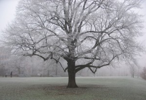
With a cold air mass spreading south over Western Washington, the first widespread frost of the season is expected tomorrow night into Saturday morning as temperatures dip to the freezing mark.
Frost was already seen early this morning in some parts of the metro area as clear skies allowed the mercury to drop into the lower- to mid-30s. (Sea-Tac Airport, for one, bottomed out at 34 degrees—the coldest reading there since last March.) It’s important to realize that, because the ground is a little colder than the air right above it during the overnight hours, frost is often observed with temperatures in the mid 30s—since thermometers are generally located about five to six feet above the surface. Actual ground temperatures, of course, will always be 32 degrees or less whenever frost is present.

After some partial sunshine this afternoon (and temperatures warming to 50 degrees), more lows in the mid 30s are likely again tonight, even falling into the upper 20s in outlying areas. Much like today, pockets of fog and frost are also possible early tomorrow, especially south and east of the city.
Things clear up later Friday morning, with partly to mostly sunny skies holding through the evening. With a cold upper level low firmly in place along the West Coast, temperatures will peak at a cool 45 degrees—about seven degrees below average.
It’ll turn even colder as darkness sets in, with the mercury plummeting into the low 30s by early Saturday. It’s then when most of the area, including Seattle proper, should see its first frost. Coming just one day before Nov. 11, the average date of the city’s first frost, this is very typical—if not almost perfectly on cue.
Temperatures for the rest of Saturday will remain chilly, with the mercury again struggling to reach the mid 40s. On the plus side, skies will be clear once more, making for a crisp, sunny fall day.
Another frost is possible Sunday morning, before warmer air wrapped up in our next rainmaker shoots temperatures back to near 50 degrees later in the day. The mild rain should arrive in the evening and continue overnight into Monday—yielding a much warmer morning.
And a sure-fire signal that Mother Nature told the frost to get lost.


I just realized I’m 1 of 5 subscribers. Want to say: thanks, I appreciate your weather insights, frequency, and focus to the point!
Goodbye!
Thanks, Edgardo–I appreciate your loyal readership! (And hopefully we get some more exciting weather soon…)