
13 days into the new year, and we’ve already topped the coldest temperature seen in all of 2012—twice.
After plunging to 25 degrees on Saturday morning, the thermometer at Sea-Tac Airport dipped to 24 at sunrise today, two degrees cooler than last year’s low of 26, set on a snowy Sunday in January. The chilly reading marks the most frigid temperature in Seattle since the mercury nose-dived to 19 degrees on Feb. 26, 2011—nearly two years ago.
Abundant winter sunshine has since pushed temperatures into the 35- to 37-degree range around the Sound—about as warm as it’ll get over the next 24 hours. With clouds funneling into Western Washington from the north, temperatures through Monday should be capped in the upper 30s—extending our stretch of sub-40 degree temperatures to five days.
In addition to the cloudy skies, very light flurries are also possible late tonight and tomorrow, with the best odds north of Seattle up to Bellingham. Anything that falls will be insignificant—there won’t be any accumulation around Puget Sound—leaving Seattle’s winter snowfall total stuck at a dismal 0.6 inches.
On Tuesday, warmer air streams in overhead as a ridge of high pressure inches toward the state—but with extensive cloudcover trapping the coldest air at the surface, we’ll stay in the icebox another day. Highs on Tuesday should again remain in the 30s, with overnight lows dropping into the upper 20s. Temperatures will actually be warmer in the mountains—above the cold air—with highs reaching into the mid 40s.
The clouds thin out a bit on Wednesday, nudging the mercury upward of 40 degrees if enough sunshine breaks through. The same holds true for Thursday—absent any low clouds or fog, Seattle could warm into the lower 40s. If the clouds dig in their heels, though, the thermometer won’t make it out of the upper 30s. In either case, temperatures will remain solidly below normal—the average mid-January high around here is 47 degrees.
Speaking of the unusual, precipitation will also be in short supply during the coming week. In fact, outside of any isolated flurries tomorrow, it looks absolutely bone dry in Western Washington through at least next Saturday—and probably beyond. Fortunately, our January rainfall is already above average—we’ve collected 2.71 inches through the 12th, compared to the norm of 2.27 inches—so Puget Sound lawns should stay green for some time.
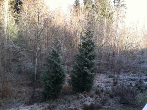
That is, if they’re not covered in frost indefinitely.


when is snow expected in seattle in january? im waiting for snow but it is just so cold and dry..
I wish I could say flakes were in the forecast, but unfortunately, there’s no sign of snow for at least the next 10 days. I’m right there with you, though—I could really go for a good snowstorm! Fortunately, there’s still plenty of winter left—it just looks chilly and bone dry until the middle of next week.