A Super Bowl win, followed by sunshine and a chance of snow?
It doesn’t get much better than this for Seattle—provided you don’t mind the cold.
Arctic air is trickling into our championship city today, driven south by a frigid area of high pressure perched over B.C. This has made for noticeably cooler conditions across the metro area, with most places hugging the upper 30s at lunchtime. As the day wears on, we’ll warm up a tad, with afternoon sunshine taking us to the lower 40s.
Temperatures drop off rapidly tonight under clear skies, sinking to the upper 20s by sunrise tomorrow. With a continued supply of cold air descending on us from the north, highs on Tuesday will struggle to reach the mid 30s—a good 15 degrees below normal for this time of year. Sunshine, however, will prevail throughout Puget Sound as Mother Nature smiles on the 12th man.
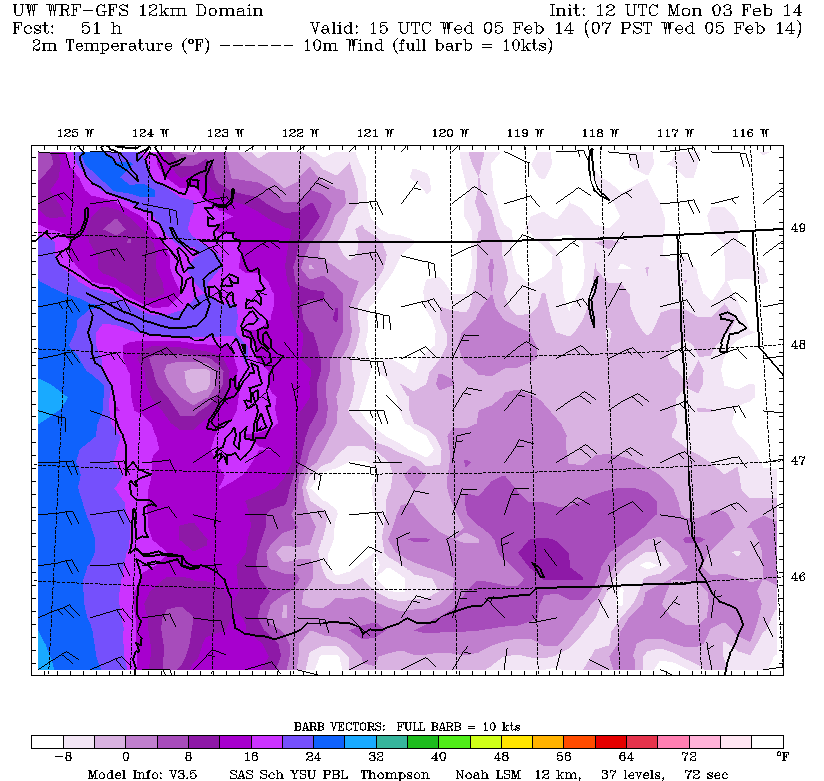
Then comes parade day. Wednesday morning should start off rather nippy, with the mercury bottoming out in the lower 20s—the coldest we’ve been since early December. Stiff northerly breezes will only add to the chill. Fortunately, the sun will be out in full force, allowing temperatures to rebound somewhat by late morning—Seattle should be near the freezing mark by the time the festivities get under way. The rest of the day will feature continued sunny, cold conditions, with highs creeping into the mid 30s.
It’s more of the same for Thursday and Friday, albeit slightly cooler—especially in the mornings. Seattle is likely to plunge into the teens both days, threatening the all-time record low temperatures for Feb. 6 and 7 of 20 and 18 degrees, respectively. High temperatures won’t fare much better, barely cracking the lower 30s.
After a cold, clear start to the day on Saturday, clouds increase rapidly as a juicy system approaches from the west. With plenty of frigid air locked in place at the surface, precipitation should begin as snow for all of Western Washington—Seattle included. It’s the timing of the storm that’s more up in the air—earlier weather models called for snow to begin Saturday morning, but newer ones suggest the flakes won’t start flying until Saturday night.
In any case, plan on light snow at times Saturday into Sunday, with temperatures slowly nudging above freezing as the winds flip from east to southwest. With the shift in direction, warmer air from the Pacific will begin surging into the region midday Sunday, changing the snow to rain and bumping readings back into the upper 30s.
At this point, it looks like most spots in the metro area will pick up an inch or two of snow before the transition occurs—not a major snowstorm for the city, but potentially the most we’ve seen in almost two years. (Sea-Tac officially logged 1.1 inches back on Dec. 20—prior to that, we hadn’t scored more than an inch since the big snows of January 2012.) Higher totals are possible west of the Sound, where cool easterly winds bunching up against the Olympics could deliver 4-plus inches of the white stuff to Hood Canal and the Kitsap Peninsula.
By next Monday, all of Western Washington should be back in the rain as warmer, more typical weather sets in. Until then, though, it’s a week of extremes for Seattle—more than fitting during this special time.
Just make sure to bundle up before celebrating.
Way to go, Hawks!

